
Walk a Salmon Creek Street
A street directory search is strongest when it moves from the address to the parcel, then from the parcel to dated records. Clark County publishes ownership and assessment facts, but it does not publish a live list of every person in each home. A deed names parties to an instrument. A permit may name an applicant or contractor. A verified period directory can name a householder or subscriber. Those roles are evidence, not interchangeable labels for a resident.
- Normalize the house number, NE or NW direction, street name, and type. Keep any older rural-route or spelling variant.
- Search Clark County PIC by full or partial address. Record the tax account, situs address, legal description, jurisdiction, and sale links.
- Open the parcel in MapsOnline. Identify adjacent taxlots, the subdivision, street segment, and any annexation or ZIP layer needed.
- Follow the latest sale into Landmark, then trace each grantor and grantee while matching the legal description.
- Use permits, a lawful voter extract, or an inspected period directory only for the date and role each source supports.
Salmon Creek Street Search Fields
The Clark County Property Information Center, or PIC, accepts a street address or tax account. Partial address strings are allowed. The result can link to assessment data, legal description, sales, permits, recorded documents, and maps. Owner-name search is not offered on the public web form; the Assessor provides that route on county self-service computers.
| Tool | Address input | Useful result | Caution |
|---|---|---|---|
| PIC | Street, house number, partial address, tax account | Account, situs, owner, legal description, sales, permits | Owner-name search is office-only |
| MapsOnline | Tax parcel, house number, street address | Taxlot, map attributes, PIC link | Map is not a legal survey |
| Addressing map | Road, direction, block, ZIP | Address point, quadrant, taxlot, annexation | Save layer date |
| LMS permits | Address, permit, contractor, date, project | Case type, issue date, status, documents | Applicant need not be resident |
Open the official PIC address form before using the captured interface below.
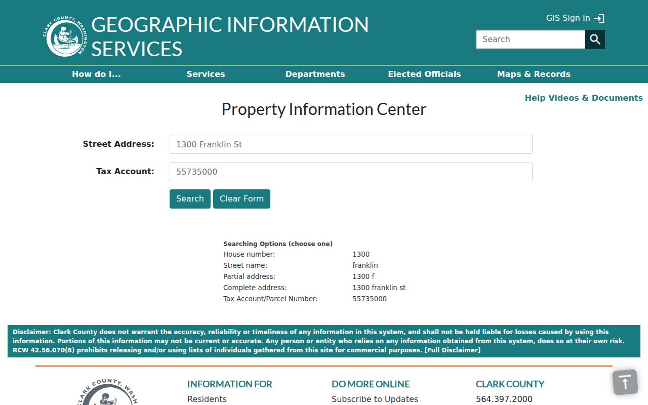
The form provides the parcel key needed to avoid joining records only because two addresses look alike.
Map Salmon Creek Street Parcels
MapsOnline turns one parcel result into a street-level view. Use Find Parcel, then select the correct layer before clicking Identify. Taxlots, roads, building footprints, subdivisions, school and district boundaries, hazards, permits, annexations, and ZIP layers can supply context. None is a household roster, and the visible line is not legal proof of a boundary.
The county Addressing service is especially useful on Salmon Creek's directional grid. It documents Duplicate Address, Address Hundred Block Group, Street Directional Quadrant, Clark County and Vancouver address grids, roads, taxlots, subdivisions, and annexations. A false nonmatch may come from an omitted NE or NW, a changed road form, or a duplicate address. Compare the tax account and legal description before deciding two entries describe the same land.
View Clark County's parcel map and note the active layer shown in this captured screen.
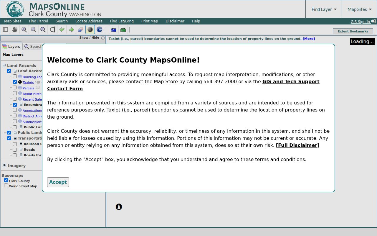
The spatial view helps define the street segment while PIC remains the source for parcel facts.
Salmon Creek Records by Street
Each address-keyed record answers a different question. A defensible Salmon Creek street directory preserves the source date and the role shown instead of turning every named party into an occupant.
| Record Set | Keeper | What It Shows | Access |
|---|---|---|---|
| Property roll | Clark County Assessor | Owner, situs, mailing address, account, value | Free address/account portal |
| GIS parcel map | Clark County GIS | Taxlots, streets, subdivisions, layers | Free MapsOnline viewer |
| Deeds and plats | Clark County Auditor | Parties, instrument, date, legal description | Free 1961-present index; copies by order |
| Voter data | Washington Secretary of State | Permitted public registration fields | Formal extract request; protected data withheld |
| Building permits | Clark County Community Development | Case type, issued date, status, documents | LMS/PIC; older papers by request |
The tax account and legal description are safer links than the street text alone. They connect PIC to sales, deeds, plats, and permits even when a number changes. A public voter extract may add a registered residential address, but VoteWA itself is only for a voter checking their own record.
Read Salmon Creek Address Terms
County property and map systems use a few terms that prevent major street-search errors. Define them before copying a field into research notes.
- Parcel or taxlot
- A mapped unit of land tied to a county tax account.
- Situs address
- The physical address assigned to the property, which may differ from the owner's mailing address.
- Plat
- A recorded map showing lots, streets, easements, and subdivision details.
- Legal description
- The recorded text identifying land, often by lot, block, subdivision, or survey.
- Criss-cross directory
- A dated directory arranged by street and house number rather than only by surname.
A mailing address may point outside Salmon Creek. A trust or estate may appear as owner. Neither fact proves who slept at the situs address on the retrieval date.
Deeds Along Salmon Creek Streets
The Landmark recorded-document index begins online on January 1, 1961. Search the current grantee around the PIC sale date, capture the recording number and legal description, then work backward through each grantor. Separate deeds and transfer-on-death instruments from mortgages, deeds of trust, reconveyances, easements, liens, and trustee notices. They do not all show a change of ownership.
Landmark accepts a name with Starts With, Contains, or Equals, document category, begin and end dates, recent-day filters, and book/page controls. If the street address changes, compare the subdivision, lot and block, short plat, boundary adjustment, and taxlot geometry. For records before the web cutoff, contact the Recording Department by phone at 564-397-2208 or email recording@clark.wa.gov. Copies may be requested online, by mail, or in person; web images are not certified.
Inspect Landmark's detailed search controls beside the captured screen.
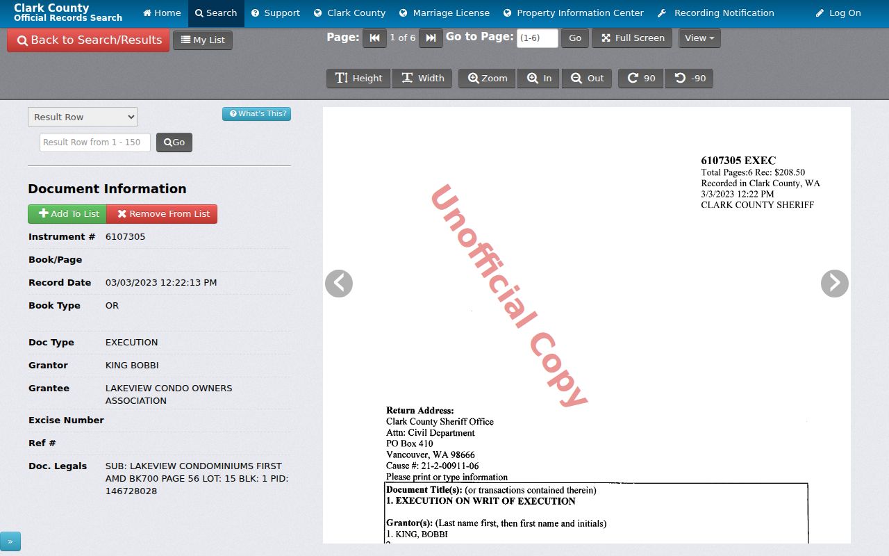
The form supports a party-and-date chain, while PIC and the legal description keep that chain tied to the correct street parcel.
Salmon Creek Permits by Address
Clark County Community Development's LMS portal can search permits by address, permit number, contractor, date, or project name. The PIC Permits tab combines current LMS entries with retired Tidemark records. Results may show case type, issued date, status, and a document icon. Missing Tidemark papers can be requested through the county public-records route.
Permits can date construction, additions, demolition, mechanical or plumbing work, signs, solar work, road cuts, and other changes. They can explain why one taxlot gained several address points or why an old structure disappeared. Yet a contractor, applicant, or listed owner is not automatically a resident. Use a permit to document work at the address, then look for separate evidence of occupancy.
Note: Check PIC's jurisdiction field first because a parcel inside Vancouver city limits follows the city's permit system, not the county's.
Historical Salmon Creek Street Clues
A reverse or criss-cross directory can connect a house number to a subscriber or householder for one edition. No official online catalog confirmed a complete Salmon Creek reverse-directory run, so do not assume a year exists. The Washington State Library lists Clark County directories for 1918-19, 1921, 1928-29, 1931, and 1934. Each volume must be inspected for geographic scope and street arrangement.
Fort Vancouver Regional Libraries offers genealogy databases, maps, census resources, and a microfilm reader at Vancouver Community Library. The Clark County Genealogical Society Library has public access and local holdings. Search Vancouver, Clark County, the subdivision, rural route, and directional variants when Salmon Creek is absent from the index. The full shelf and entry-reading method belongs on the historical city directory page.
Salmon Creek Address Changes
Salmon Creek is a CDP and unincorporated community, not a city boundary. A record may use Vancouver as its mailing city while Clark County controls the parcel. Historical files may instead use a township, rural route, precinct, subdivision, or older road form. A modern neighborhood or CDP label should not be projected backward without a dated map.
The Addressing service's annexation, taxlot, subdivision, directional-quadrant, duplicate-address, and hundred-block layers can diagnose a mismatch. Still, the research did not establish a single year for every local renumbering or road-name change. Use a period plat, deed, directory, or map before claiming that two street forms are equivalent.
Build a Salmon Creek Street Inventory
A whole-street project should be organized as a parcel table, not copied from a list of names. Start one row for each taxlot touching the defined street segment. Record the street number and direction, normalized road name, tax account, situs address, legal description or parcel identifier, jurisdiction, owner field as displayed, mailing-address difference, latest deed date, permit date and status, and source date. Keep parcels that merely touch at a corner in a separate group if adjacency matters.
This method makes gaps visible. A shared driveway can put several address points near one taxlot. A condominium may place many units within one mapped outline. A short plat, boundary-line adjustment, road vacation, or subdivision may mean today's parcel set did not exist in the target year. Open each PIC result rather than assuming the map label supplies all facts. When a boundary conclusion has legal importance, obtain the recorded plat or a survey.
The street table should also preserve roles. Mark a deed party as grantor or grantee, a permit name as applicant or contractor, and a directory name as householder or subscriber. Do not collapse those fields into one resident column. A street directory becomes far more reliable when every name retains the record type, date, and exact address form that produced it.
Voter Data for Salmon Creek Streets
Washington does not offer a public web map of registered voters by street. VoteWA is for a voter checking their own information with an exact first name, last name, and date of birth. A lawful public-data project uses the Secretary of State VRDB extract request. Clark County Elections directs statewide voter-database requests there under RCW 29A.08.105(3).
The public extract can include permitted names, addresses, year of birth, voting history, precincts, and districts. It does not disclose full dates of birth, driver-license data, Social Security digits, phone numbers, email, future-voter information, or protected records. Voting history shows participation, never a ballot choice. The state describes a CSV delivery route and fulfillment of up to five business days.
Filter a returned file only within the request's lawful purpose, keep its as-of date, and normalize street directions without deleting the original text. A registration address is a dated official clue, not proof that the voter occupies the parcel today. Address Confidentiality Program records and other protected options must never be reconstructed from other sources.
Limits of Salmon Creek Street Records
A Salmon Creek street directory cannot deliver a complete, live household list. PIC and MapsOnline focus on parcels and ownership. Landmark indexes parties to documents. Permit systems name project roles. Voter information covers registered voters through authorized channels and omits protected data. A period directory captures only the people and addresses included in that edition. Renters, children, unlisted subscribers, recent movers, and other occupants may never appear.
Washington's Address Confidentiality Program provides a substitute address for eligible participants. Protected voter and marriage options can hide an actual address. Do not try to defeat those safeguards by joining several sources. Publish the least detail needed, keep dates attached to each result, and contact the custodian when a record appears wrong.
Lawful use. Salmon Creek address records support personal research and civic questions. Never use them to stalk, harass, threaten, or expose a protected person.