
Salmon Creek ZIP Coverage
Three working ZIP codes recur in official records for the Salmon Creek area. USPS identifies them within the Vancouver delivery system, not as exclusive Salmon Creek zones. County places such as Felida, Hazel Dell, Klineline Pond, and the NE Salmon Creek corridor help orient a search, but none substitutes for an address-level postal or parcel check.
| ZIP Code | Areas Covered | Post Office | Notes |
|---|---|---|---|
| 98665 | West and southwest Salmon Creek context, with Hazel Dell and Vancouver overlap | Vancouver delivery area | Verify CDP and parcel jurisdiction |
| 98685 | Northwest corridor, Felida connections, Klineline and park context | Vancouver delivery area | Crosses several community labels |
| 98686 | North and northeast Salmon Creek address pattern | Vancouver delivery area | Common along NE directional streets |
None of these three should be described as a Salmon Creek-only ZIP. The USPS Office of Inspector General report confirms that the Vancouver main post-office service area includes all three. It does not define their exact street edges. Use the ZIP code directory as a first filter, then confirm each returned address in USPS and Clark County tools.
Verify Salmon Creek Postal Addresses
The official USPS ZIP Code Lookup accepts a complete street address and returns the preferred postal city, state, ZIP code, and, when available, ZIP+4. Search by address when a record contains a house number. The city-and-state mode is broader and can return several codes, so it cannot establish which one serves a parcel.
| Lookup field | How to use it | What it establishes |
|---|---|---|
| Street address | Enter house number and full street name | USPS delivery spelling and ZIP |
| City and state | Use Vancouver, Washington for broad discovery | Possible postal codes, not parcel location |
| ZIP code | Reverse-check a known code | USPS city names associated with that code |
| ZIP+4 | Use the full returned delivery code | A finer mail-delivery segment |
A USPS result validates mailing use. It does not guarantee that a place lies inside the census-designated area or Vancouver city limits. Preserve the standardized street form because directional prefixes such as NE and NW can change which address is found in county databases.
Salmon Creek ZIPs and ZCTAs
The Census Bureau creates ZIP Code Tabulation Areas, or ZCTAs, to summarize statistics around clusters of residential mailing addresses. USPS ZIP codes are delivery routes that can change as mail operations change. A ZCTA is therefore a Census approximation, not an official USPS boundary. It may be noncontiguous, and some special or PO-box-only ZIP codes may not receive their own normal ZCTA.
The Census ZCTA explanation is the right source for that distinction.
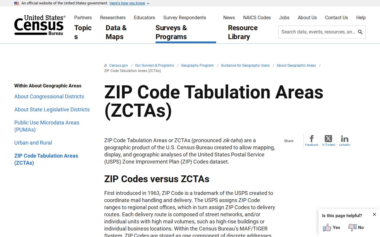
The captured guidance shows why Census totals cannot be treated as a household list for a USPS route.
Find Salmon Creek Residents by ZIP
No open county portal provides a one-click roster of all residents in a ZIP. Work from official address and boundary records, and keep owners, occupants, and registered voters distinct. The PIC public form searches an address or tax account, while owner-name searching is limited to assessor office self-service computers. MapsOnline supplies the ZIP, taxlot, road, annexation, and subdivision layers needed to interpret a result.
- Standardize the complete address with USPS and save the returned postal city, ZIP, and ZIP+4.
- Search the address in Clark County PIC. Record the tax account, site address, owner mailing address, and jurisdiction.
- Open MapsOnline and compare the parcel with ZIP, CDP, city-limit, taxlot, and neighborhood layers.
- For permitted voter research, use a defined Secretary of State VRDB extract scope. Do not use VoteWA to enumerate households.
Once a postal area narrows to a named road, the Salmon Creek street directory explains the full address-to-parcel trail. A ZIP-wide count or list must retain its as-of date and boundary definition because delivery, Census, voting, and property layers cover different groups.
Mapping Salmon Creek ZIP Results
MapsOnline is the practical bridge from postal wording to public-record geography. Use Find Parcel for the standardized address, then Identify on the taxlot. Turn on roads, ZIP, taxlot, subdivisions, directional quadrants, and annexations as needed. The result can show why a Vancouver mailing address belongs to unincorporated Clark County or why a modern neighborhood term does not appear in an old deed.
The Clark County map viewer provides context around one taxlot. It is not a resident roll or a substitute for a legal survey.
The W.H. Robinson House is a useful example of changing local geography. The county identifies the circa-1901 farm site on NE Salmon Creek Avenue and notes later subdivision. Current records may now use multiple taxlots, newer roads, and the 98686 postal context. That does not mean the modern ZIP existed in the historic record.
Salmon Creek ZIP Voter Filters
VoteWA is a private self-lookup requiring the voter's exact first name, last name, and date of birth. It cannot be browsed by ZIP. A public voter-data project must use the Secretary of State VRDB extract, comply with the live terms, and define its scope. The extract can supply active voters, permitted address fields, voting history, districts, and precincts in CSV form.
A ZIP filter in that file is only a postal sort. It omits people who are not registered and may include addresses outside the Salmon Creek CDP. Protected addresses, future-voter data, full birth dates, driver-license data, Social Security digits, phone numbers, and email are not ordinary public fields. Save the extract date because the statewide database updates monthly.
Define a reproducible query before requesting the file. State whether the project means all records carrying one ZIP, parcels inside the Census CDP, a set of precincts, or named neighborhood boundaries. Those populations will differ. Clark County Elections remains the local source for precinct and district administration, but statewide voter-data requests now route to the Secretary of State under RCW 29A.08.105(3).
Older Salmon Creek Address Labels
Historic records may identify Vancouver, Clark County, a township, subdivision, rural route, box, or road name without a current ZIP code. The NE and NW directional grid can also produce false matches if a prefix is dropped. Search the exact historic form first. Then try the Vancouver postal form, the street without abbreviation, and the legal description or lot and block.
County addressing layers include duplicate addresses, hundred-block groups, street directional quadrants, annexations, taxlots, and subdivisions. These layers can diagnose a mismatch, but they do not prove when a road name changed. The research found no official year for a Salmon Creek-wide renumbering. A dated plat, deed, directory street guide, or newspaper notice is needed before stating that two historic addresses are the same place.
For a house-history search, anchor the trail to a legal description and tax account before comparing postal labels. The Auditor's Landmark index begins online in 1961; older deeds need Recording Department help. A city directory may list a rural route or Vancouver heading, while a census may use a district rather than any modern ZIP. Keep the original wording beside the normalized current address.
Early county continuity has another limit. A November 1890 courthouse fire destroyed most older Clark County records. Missing early deeds or cases may reflect that loss. State Archives, tax ledgers, census records, newspapers, church material, and later confirming deeds can bridge parts of the gap, but none supplies a complete historic ZIP-to-household crosswalk.
Salmon Creek ZIP Boundary Limits
Salmon Creek is a Census-designated place and an unincorporated community, not a city with its own clerk or municipal records counter. Vancouver is the county seat and common postal city. A line reading “Vancouver, WA” may describe mail delivery rather than city jurisdiction. ZIP, ZCTA, CDP, precinct, neighborhood association, and parcel boundaries must remain separate in any directory result.
- ZIP and ZIP+4
- A ZIP serves a broad delivery area. ZIP+4 identifies a smaller delivery segment, such as part of a block or building.
- PO-box ZIP
- A code used for post-office boxes rather than ordinary street delivery.
- Unique ZIP
- A code assigned to one organization or high-volume recipient.
- Carrier route
- The operational path used to deliver mail, which is not a civic boundary.
No official source in the research fixed a dated local ZIP split or a complete historic ZIP crosswalk. Do not invent one. For an old address, preserve the period wording, search rural-route and directional variants, and use dated deeds, plats, directories, and maps to bridge it to a current parcel.
Salmon Creek's population grew between the 2010 and 2020 Census counts, and the area's farm and subdivision history can reasonably suggest more parcels and address forms over time. That is context, not proof of why any one ZIP changed. Use dated postal and county records for a specific address. Modern neighborhood names and park corridors should be added only after the parcel and postal facts are fixed.
When reporting a ZIP result, state three things: the postal code returned by USPS, the parcel jurisdiction returned by Clark County, and the geographic label used for the project. A clear record might read “98685 postal address, unincorporated Clark County parcel, inside or outside the selected Salmon Creek boundary.” That wording keeps a directory search from silently turning a mail route into a city line.